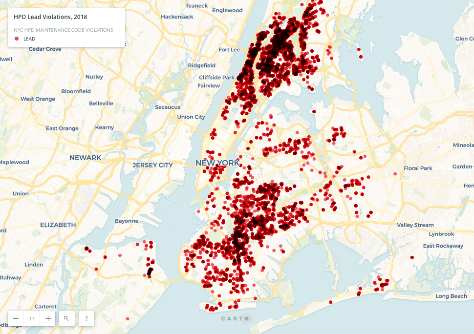
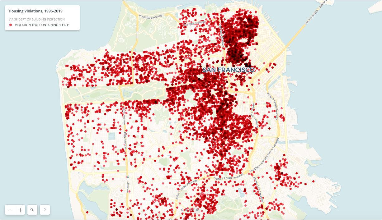
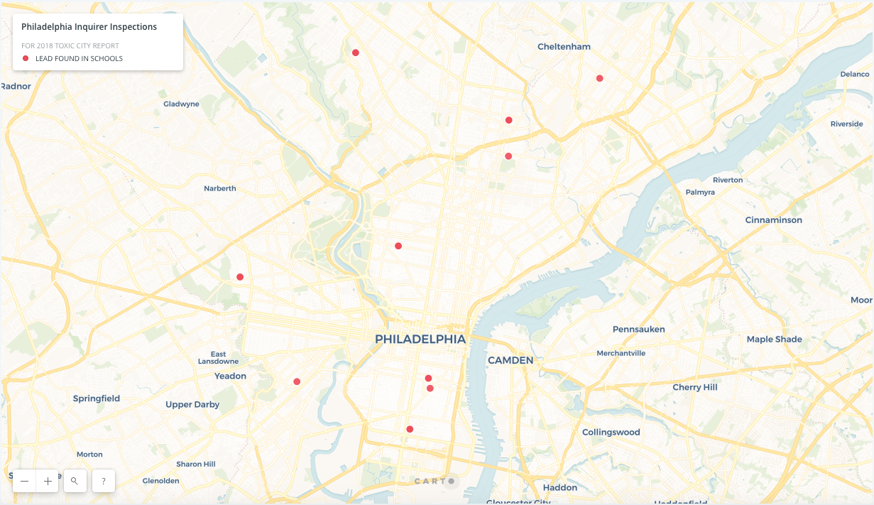
The American Lead Map is a collaborative community-based research initiative to create the nation's first crowd-sourced open online map identifying toxic lead hazards in American cities, integrating data from cities in all 50 states and Puerto Rico.


This research is important, as leading public health experts estimate that currently over 500,000 children below the age of six are injured each year through their exposure to lead dust found in the home and in the landscape, with permanent cognitive deficits. Experts calculate that over 9 million US children have lead blood levels which may cause sub-clinical signs and permanent adverse health, cognitive, and behavior outcomes.
To enable the public sharing and use of both expert and locally sourced data on intra-urban concentrations of lead hazards – an unevenly shared risk within cities – we will collaborate with community groups, municipal agencies, and lead hazard scholars to co-create an online map that identifies available data on lead in urban soils, lead paint hazards within buildings, and lead hazards in post-industrial sites. The research will initially focus on the online mapping of currently available lead hazards from American cities, expanding to other intra-urban locales and seeking to create a model replicable to any interested jurisdiction or community organization. The project will initially assess existing lead hazard reporting practices that vary by municipality and collect relevant datasets made public by local governments, in addition to other spatial lead data collected by academic, nonprofit, and journalistic entities. We are actively seeking co-investigators for the lead map project. We also plan to develop an application for mobile access to environmental data to explore the potential for integrating citizen-sourced data.
For further information on the Lead Map Collaboratory:
Joyce Klein-Rosenthal, PhD, MPH
Associate Adj. Research Scholar
[email protected]
Further Reading
- Center for Disease Control and Prevention. (2016) “Childhood Lead Poisoning Data, Statistics, and Surveillance.” https://www.cdc.gov/nceh/lead/data/index.htm
- CDC’s childhood lead poisoning tracker by state, as part of the Healthy People 2020 objective of reducing childhood lead poisoning in the US.
- City of New York. (2019) “Lead Free NYC” https://www1.nyc.gov/content/leadfree/pages/
- In response to media attention surrounding the discovery of lead in public housing and schools, the City of New York developed a multi-agency roadmap to eliminating childhood lead exposure by 2029.
- Frostenson, S. & Kliff, S. (2016) “The risk of lead poisoning isn’t just in Flint. So we mapped the risk of every neighborhood in America.” Vox. https://www.vox.com/a/lead-exposure-risk-map
- An analysis conducted by Vox and Washington State Department of Health to algorithmically determine lead risk across the United States using on housing stock age and poverty data.
- Green & Healthy Homes Initiative. (2019) “Ending Lead Poisoning.” https://www.greenandhealthyhomes.org/ending-lead-poisoning/
- Nonprofit organization advocating for legislation and offering grants to projects that prevent lead poisoning.
- Mielke, H. & McLachlan, J.A. (2013) “Lead’s Urban Legacy.” http://lead.tulane.edu/index.html
- Overview of sources of urban lead hazards and historical context, with a focus on New Orleans.
- Philadelphia Inquirer. (2017) “Toxic City: The Ongoing Struggle to Protect Philadelphia’s Children from Environmental Harm.” http://media.philly.com/storage/special_projects/toxic_city_landing_page.html
- Major investigative piece that combined original inspection work with existing government data to highlight the spectrum of Philadelphia’s lead hazards in schools, soil and homes.
